

In January the FieldSim® app, which assists farmers in agroecological decisions has been deployed for the first time in the Vihiga county, Kenya. FieldSim is a mobile application developed by the company eTumba. It integrates indicators generated by the ITK Cropwin model with the aim to help farmers manage their crop. These indicators simulate the effects of farming practices on crop growth and development, as well as on soil carbon storage.
Throughout this first census campaign, more than 300 farmers were closely followed by county Extension Officers via the application. Personalized advice sent by sms to growers aim at:
Boosting maize yields thus ensuring food autonomy for Kenyan small-holder farmers
Agronomic models provide field-scale recommendations. These recommendations will be sent to farmers via messages to increase their skills and secure future harvests. Additional earnings may allow to buy certified seeds and adapted fertilizers.
Improving soil health
Optimization of farming practices and nitrogen input contribute to protect the soil from erosion and nutriments run-off. Crops growing in a healthy soil are expected to better cope with extreme weather events.
Increase carbon sequestration
By simulating the quantity of delta carbon newly stored in the soil during the cropping season, the application will help farmers to adapt their farming practices to maximize carbon storage. High levels of soil organic matter increase soil structure, hence resilience and productivity. The KILIMO project therefore contributes to reduce greenhouse gas emissions and to stop climate change
James Matika, Extension Officer for the Emuhaya sub-county (Vihiga, Kenya)
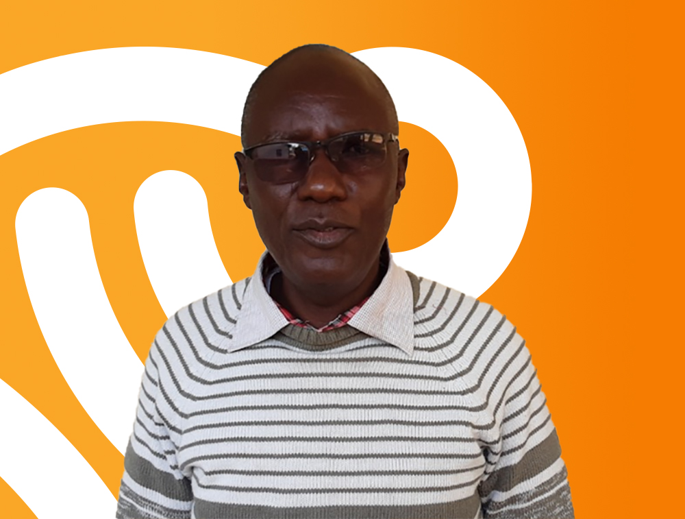
As extension officers, James Matika and his counterparts have been working for the county department of Agriculture to transfer and exchange any relevant agricultural information, knowledge, innovations, or skills to the farming communities to optimize their production. “We used to build cropping calendars to collect information on sowing and harvesting periods across the county to provide recommendation for farmers, but this was taking too much time”, says James Matika.
Collecting the information and reaching farmers in time is actually one of the biggest issues faced by the extension officers of the Vihiga county. Digitalisation of farmer information will save time. “The app will help us to reach more farmers and to set up individualised crop planning more efficiently”.
« For the first time, farmers will know the surface of their land. »
Early this year, James Matika and ten extension officers “put their boots on” to visit farmers. With the FieldSim® app set on their tablet, they were able to register more than 300 farmers within only three days. They collected general information, such as name and gender, and more importantly a phone number. “This will greatly facilitate communication” says James Matika. “We usually follow about 1,000 farmers over the growing season.” The app has been designed to assist extension officers in sending automatic farming practice recommendations via text or audio messages.
« It will be easier to reach farmers and to provide them with in-season recommendations at the right time. »
Towards a more productive and sustainable agriculture
By activating the GPS signal and walking around maize fields with their tablets, extension officers were able to record plot delineation directly in the app. “For the first time, farmers will know the surface of their land. This will allow them to adjust the amount of nitrogen fertilizer they really need”. This is a big shift in thinking. At last, farmers and extension officers will be able to adjust the amount of fertilizer by thinking in terms of kilograms per acres rather than just kilograms. This is a first step towards input optimization and environmental conservation.
The FieldSim® app also provides a 5-days weather forecast. “As rain comes from the West, there can be few weeks difference in sowing dates between eastern and western wards. With access to weather forecast by location, I will be able to provide personalized advice such as ideal sowing or harvest windows”.
James Matika is also planning to run specific training for group leaders to spread favourable farming practices for productivity while preserving soil health. “Thanks to the cartography and geolocation from the FieldSim® app, we will be able to find farmer clusters and identify a group leader for each location”. By training a small subset of farmers willing to change their farming practices, James Matika is hoping that the new methods will be widely spread in no time.
It is definitely a great kick-off for project Kilimo, which will help not only small farmers to improve their yields but also contribute to global environmental health through adequate farming practices.
Today, across developed countries, there is a duality between the need to produce food and the increase in the awareness of the production system’s sustainability loss, as over time, intensive agriculture has degraded our soils and depleted its biodiversity.
In 2020, we no longer have the choice of using more land to increase production; competitive pressure on land use is really strong. In France for example, we have already lost the equivalent of a French agricultural land province in 10 years of urbanisation.
The experience gained by triggering environmental imbalances in developed countries must keep it a habit not to reproduce bad productive practices in developing countries. Do we always need to prioritise food production as opposed to soil health and the reduction of greenhouse gas carbon emissions? Three major ambitions must be carried out by agriculture during our time: it must play a central role in the fight against the effects of climate change, while ensuring food security and the preservation of biodiversity.
Climate has no borders. We can act on a planetary scale. In this case, KILIMO is a collaborative research and technological innovation project that contributes to improving performance in agriculture while preserving Kenya’s environment.
The storage of carbon in agricultural soils is one of the solutions to make agricultural production a sustainable sector. The 4 per 1000 initiative estimates that an annual increase of 0.4% in carbon sequestration in the first 30 to 40 cm of soil may be enough to offset the loss of CO2 to the atmosphere due to human activities. And it is still an achievable goal if there is a real change in farming systems.
itk is a member of the 4p1000 initiative, and the KILIMO Project for the Transformation of Kenyan Agriculture is a concrete action that contributes to this initiative.
Thanks to the agronomic modeling tools, new avenues are explored for agricultural systems to combine optimal production levels, with minimal input applications and agricultural practices that ensure carbon sequestration in fields.
The decision-making process to combine all the factors – amount of irrigation, date of fertilisation, practices favouring carbon sequestration, etc. – is complex to understand. This is why, at itk, we make the results of agricultural research accessible through visually simple decision support tools (DST) as a result from crop modeling and artificial intelligence (previously developed for the EU and the USA ), already marketed and used for precision agriculture.
Within the KILIMO project consortium, our partners also have solutions and tools that provide satellite imagery and local field observations. Based on an exchange of data (big data) and transfer of technological knowledge, this cooperation will give way in the creation of an innovative tool, easy to use and with major added value. This breakthrough will not only serve precision agriculture, but also soil conservation agriculture and regenerative agriculture.
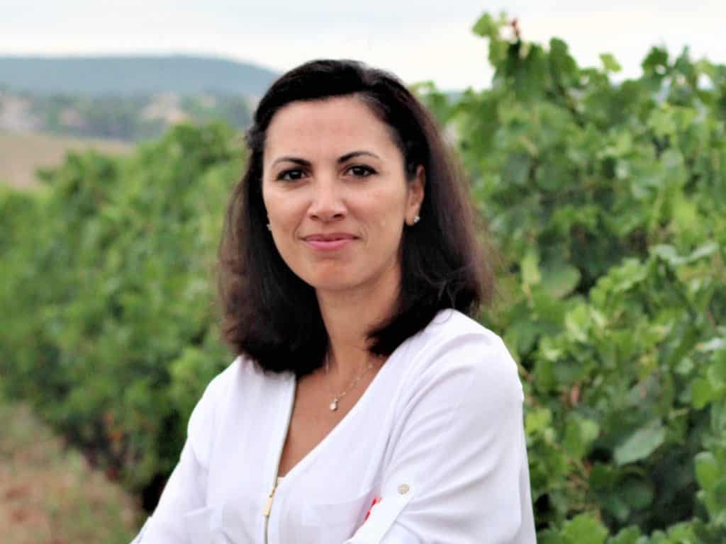
I am very proud that itk is part of a project that aims to prove that the reconciliation of productivity, profitability and protection of soil health is possible, with the collaboration of other partners who have the same conviction and the same goal. Vihiga County will be a pioneer and model for other counties in Kenya, for other African countries as well as across the world. We will prove that an agricultural system can be driven in the most sustainable way, remain highly productive and at the same time preserve the health of our soils and promote practices that significantly reduce the effects of CO2 loss and climate change.
Aline BSAIBES, Directrice Générale d’itk
ITK, the KILIMO project leader, has set up a technology consortium composed of 3 key partners to synergistically contribute to the Kilimo proof of concept for the Vihiga County.

Airbus : Satellite imaging and real time information input
Airbus is an international reference in the aerospace sector, leader in earth observation and services, including in the agricultural sector.
Airbus Defense and Space will be carrying out the automatic contouring of agricultural land boundaries based on high-definition satellite images. The Airbus information will provide maps of the field location to contribute to building the agricultural land database. Airbus generates and makes available advanced analytics derived from satellite image sequences: temporal measurements of biophysical parameters, such as the Leaf Area Index (LAI), characterizing crop development. Together with additional information from growers practices, this biological parameter will be integrated into the ITK crop model to determine fertilizer amount and optimize the timing of their application, a high value information distributed to the farmers through the FieldSim platform built by e-tumba.

LocateIT : Kenyan Géographic Information System (GIS)
LocateIT is the service provider of the Government of Vihiga for its GIS services. It is also the distributor of Airbus in Kenya (relaying geo-spatial activities locally to maximize local benefit and project sustainability). LocateIT coordinates all operations with local authorities in Kenya.
The company has in charge the agricultural land database jointly built between partners and the deployment of the solution from authorities and extension officers to Kenyan producers.
GE-DATA : Geospatial image analysis and agricultural land database
GE-DATA specializes in the generation of geo-spatial agricultural statistics from satellite images. The company builds databases of parcel data and farmer knowledge. Its mission for the KILIMO project is to couple Airbus satellite images with ground verification to estimate the total field area and maize analytics over the Vihiga County. It also pairs Airbus maps with some field surveys to classify image data.
itk : Smart agriculture modelling company and leader of the project
Itk is a knowledge integrator company from scientific research and field expertise providing tools that help strategic decision making, forecasting and managing risks, and tools for farm and livestock management. Itk uses modelling to integrate and predict impacts of farming practices on farm productivity and environment impact.
Crop models, such as the one used for maize model in Kenya, is a mechanistic model fuelled with climatic data to create a virtual twin based on biological processes such as phenology, daily biomass production, hydric and nutritional balances and yield. Such twin allows to better set and organise agricultural practices by predicting their impact on yield and soil health.
Next to the plant model, the soil model includes the dynamics of the water cycle, the nitrogen cycle and the potassium cycle. By developing a new module for the carbon cycle, itk integrates a new soil health component and make Kilimo a climate co-benefit project. Within Kilimo, this new model will be challenged with ground truthing through soil measurement between agricultural seasons. The impact of FAO recommended practices on soil carbon dynamic will be studied to link the model with carbon sequestration.
The integration of the Airbus and GE-data technologies will set the agricultural land database and fuel the model with real time inputs (LAI). The model will generate individualized technical itinerary and the FieldSim tool (E-tumba) with distribute and organise these high value data all the way from authorities to the farmers for an optimize agricultural chain management.
FieldSim: digitalisation of agricultural family producers
The FieldSim tool is a digital platform connected with itk climate-smart crop models to generate individualized agricultural itinerary by providing, for example, the optimal date and seasonal rate for fertilization and fertilizer management globally.
FieldSim is part of the KILIMO solution and contributes to the project by summarising comprehensive indicators, monitoring the agricultural chain, and communicating high value data up to the farmer level.
Data from the KILIMO project, led by agtech company itk, will also tackle the fertiliser black market through real-time satellite mapping and agronomic modelling in Vihiga County
MONTPELLIER, France – A new 18-month project will use cutting-edge digital tools to monitor agricultural soil health conditions in western Kenya and optimise the use of fertilisers, water and carbon sequestration in maize production.
Led by French agtech company itk, the KILIMO project’s aim is to demonstrate how satellite and modelling technologies can generate tailored, farm-level recommendations at scale.
Satellite imaging will be used to map and track the condition of Vihiga Country’s soils through colour spectrometry, which analyses crop colour and density. This real-time information, combined with meteorological data, will be fed into itk models to determine the appropriate amounts and types of fertiliser to be applied, and at what time, to maximise both crop productivity and sustainability.
“Technology is driving a massive transformation of African agriculture,” said Aline Bsaibes, Director General of itk. “What we learn from the KILIMO project, especially regarding soil health and the carbon cycle, can then easily be scaled to other regions or countries as well as for related climate-smart agriculture initiatives.”
Bespoke recommendations are then sent to individual farmers via SMS or voice message, ensuring that government-issued fertiliser subsidies are used efficiently. This can also reduce the scheme’s current inefficiencies as well as limiting the subsidised fertiliser black market.
The KILIMO project, which stands for “Kenyan Innovation for Low Impact Maize Production”, will track in real-time the carbon storage potential of agricultural soils as well as nitrogen and potassium levels. These technologies are already widely in use in major maize production regions around the world, including in the United States.
“Our scientific objective with the KILIMO project is to accurately capture data on the daily carbon, water and nutrient cycles of soils,” Bsaibes added. “Our decision support tools help to improve soil health, reduce fertilizer use and increase crop yields, increasing farmers’ sources of income.”
The project is being run by itk in collaboration with Airbus Defence and Space, which will undertake the initial field measurements using satellite imaging, and academic experts of the UMR Eco&sol, along with IRD, CIRAD, GE-Data (Toulouse & Washington), and Locate-It (Nairobi). The project budget is more than €800,000.
Itk already offers other digital and mobile tools to support African farmers in improving their maize and cotton production, through their partner E-tumba, which is well established on the African continent.
The KILIMO project is supported by the French Ministry of Economy and Finance, which helps French companies expand the use of green technologies globally.
About itk
Created in 2003 and managed by Aline Bsaibes, itk is a French agtech company in full international expansion. Specialising in precision farming, this scale-up is the French leader in Agri-Intelligence serving decarbonised agriculture. itk aims to improve food security, agricultural sustainability and soil health, thanks to new technologies. With its scientific expertise and knowledge in the field, itk has been developing decision support tools (DST) for almost 20 years for farms and all actors in the value chain: forecasting, risk management and cultures, etc. The company brings together 120 team members. This team of excellence draws on the skills of its computer specialists in artificial intelligence and its researchers in agronomy. Based in Clapiers near Montpellier, itk also has offices in Rennes, San Francisco (California, USA) and works for the African market thanks to its privileged partner ‘E-Tumba’. The latter offers mobile applications to improve agricultural practices and to structure actors (from family producers to processors) of an entire agricultural sector on the African continent.
Itk is a partner of the international initiative “4 per 1000: Soils for food security and climate”.